Bathymetric survey tracks the health of Tweed waterways
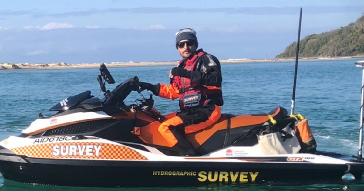
Tweed Shire Council, Marine Parks and Fisheries, and the Department of Climate Change, Energy, Environment and Water are conducting testing on Tweed waterways. Photo: SUPPLIED


TWEED residents will see a uniformed jet-skier in the coming weeks, slowly traversing local waterways as Tweed Shire Council conducts bathymetric surveys in the shire.
Tweed Shire Council flooding and stormwater engineer Leon McLean said the process mapped the underwater topography of water bodies, including rivers, lakes, estuaries, and oceans.
“It’s essentially the aquatic equivalent of topographic mapping on land,” McLean said.
“It works, typically, using a combination of GPS and sonar echo sounding, and a transducer emits sound pulses downward into the water.
“These pulses bounce off the river/seabed and return to the receiver. The GPS takes this information and georeferences it (maps the precise location in space).”
A specially equipped survey vessel will travel along planned waterway paths, collecting data continuously, which is later processed to create detailed 3D maps of the underwater terrain.
“We gather data including water depth (bathymetry), underwater topography features, locations of obstructions or debris, vegetation and in some cases, habitat mapping,” McLean said.
“The immediate purpose is to perform flood studies, however, it can also be used for environmental monitoring, tidal analyses, estuary health assessments, infrastructure planning, and similar projects.
Bathymetric surveys have been conducted on various parts of the river system in 2024, 2023, 2019, and 2018.
The current survey aims to cover Terranora and Cobaki Broadwaters, including their creeks, as well as Dunbible Creek and Marshalls Creek in Byron Shire and will be conducted through November, with the duration and location of vessels subject to weather conditions and tides.
“We do not expect any significant impacts and appreciate the community’s support and cooperation as we undertake this important work,” McLean said.
The NSW Government’s Marine Parks and Fisheries, as well as the Department of Climate Change, Energy, Environment and Water, are working with the council on the survey program.
Share


Related Articles

Thousands of bargain books up for grabs at Friends of Libraries book fair
THOUSANDS of pre-loved books will be on sale at this…
Small schools unite for Art Enrichment Day
YOUNG artists from 11 small public schools across the Tweed…