Extraordinary hand-drawn maps

This brilliant illustration includes the townships of Portarlington, Indented Head, St. Leonards, Bellarine and Drysdale.


This new Portarlington Map is brought to you by the makers of the incredibly popular Melbourne and Bellarine maps.
The small team of local artists, who work for years creating these pictorial maps, couldn’t resist turning their attention to this detailed hand-drawn illustration of the northern tip of the Bellarine.
This brilliant illustration includes the townships of Portarlington, Indented Head, St. Leonards, Bellarine and Drysdale.
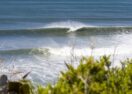
Home to the annual Mussel and Celtic festivals, gateway to magnificent wineries and local produce, a vibrant arts and culture scene, sensational golf courses, stunning beaches and so much more.
Portarlington and the nearby towns are a treasured home and holiday destination, now easily accessible from Melbourne via a daily ferry service leaving from Docklands.
More than 1,200 hours have been poured into the research, illustration and colouring and they’ve produced a beautiful range of limited-edition prints, art prints, jigsaw puzzles and tea towels – all locally made.
Each print comes with a Grid Reference and a list of things to find within the illustration.
Browse our website for the whole range of Bellarine, Melbourne and Portarlington Map products, proudly made in Australia, with all our prints made in Geelong.
Just in time for the holiday season of gift giving, you can order via the website www.themelbournemap.com.au and we’ll deliver for free.
Contact [email protected] with any questions.
Note: Christmas orders close on December 15.
// Sponsored Content
Share


Related Articles

A new home for local products
Griggs Creek Providore is on the move, headed for a…
Food that’s good for the body and soul
Nestled among the picturesque gum trees of the Bellarine Peninsula,…