Farmers and landowners wary of proposed new planning controls

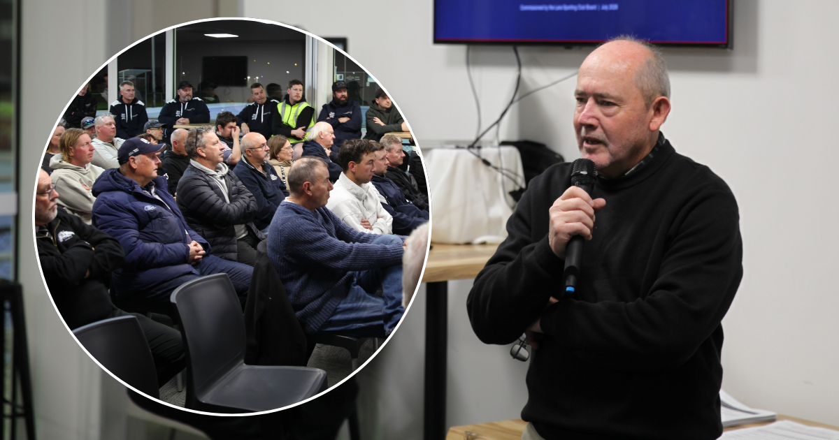
A large crowd packed the Marcus Hill Hall where a fiery workshop on the government’s proposed Agricultural Land Strategy was held.


THE public submission period for the State Government’s Protecting Strategic Agricultural Land Strategy has been extended following a fiery meeting at Marcus Hill last week.
More than 80 people packed the Marcus Hill Hall for the workshop which had only been organised a week earlier after concerns were raised by Bellarine district farmers and landholders.
The areas identified for potential Strategic Agricultural Land protection in our region include pockets of the Bellarine between Clifton Springs and Portarlington, and either side of the Bellarine Highway between Ocean Grove and Point Lonsdale.
On the Surf Coast, a large swath of land from the Surfcoast Highway near Blackgate Road and back though Bellbrae out to Paraparap has also been identified for possible planning restrictions.
The Government Strategy aims to protect areas deemed as being of strategic importance to agriculture within 100 kilometres of Melbourne so they cannot be developed for other uses.
The strategic areas were identified based on their soil type, access to water, resilience to climate change and adaptability.
But landholders at the recent meeting questioned the validity of the information used in identifying larges areas on maps as being “Strategic Agricultural Land” and felt in many cases the land had been incorrectly identified by the project team.
There were also concerns about what would be allowable in a proposed 500-metre buffer zone, which will adjoin areas identified as Strategic Agricultural Land.
Other questions raised by landholders at the workshop included: how can you assume that land identified as strategic is used for agriculture? Will future dwellings/subdivision be prohibited on strategic agricultural land? How will a strategic agricultural land declaration affect land values, especially on areas on urban boundaries?
Others questioned why the Department of Environment, Land, Water and Planning (DELWP) were identifying strategic agricultural land and not strengthening the right to farm in all agricultural areas, and whether strategic agricultural land could be compatible with tourism.
There was also great concern raised as to whether the potential areas identified have been validated on the ground to see if the studies matched reality. The DELWP project aims to see future strategic agricultural land be recognised and protected in the planning system citing that the work is about more than just protecting strategic agricultural land, but also about providing greater certainty for agricultural businesses in key precincts to support long-term investment.
However, this appears to be more about a plan to restrict development opportunities around growth towns as much of the land in these areas is of low agricultural value.
DELWP plans to release a summary of the outcomes from this consultation stage and more details on the planning response later in the year.
Landholders and farmers can make submissions on the project through the Engage Victoria website at engage.vic.gov.au/protecting-melbournes-agland until Friday May 17.
Share


Related Articles
Recruitment begins for bushfire season
JOBS for entry-level forest firefighters are now available across the…
Writers explore the power of collaboration
COLLABORATIVE writing will be the focus of this year’s Midwinter…