Town snapshot – Corio

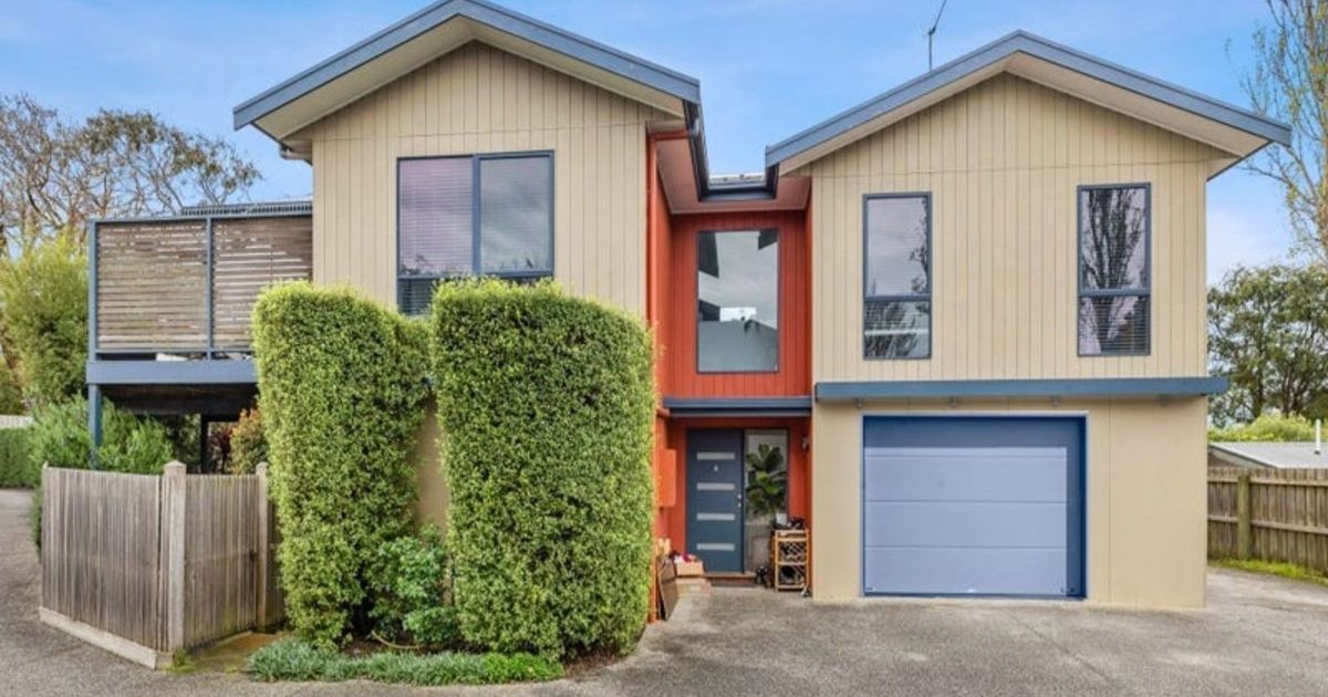
This three bedroom Corio home sold recently for $520,000


HEADER: Suburb Profile: Corio
The size of Corio is approximately 19.1 square kilometres and has 36 parks covering nearly 8.8% of total area.
The population of Corio in 2016 was 15,298 and by the 2021 Census the population was recorded at 15,497 showing a population growth of 1.3% in the area during that time.
Corio is one of Geelong’s largest and most diverse suburbs, spreading from the Shell Oil Refinery west into residential areas and north along the coast of Corio Bay.
The suburb has a vast array of public parks, reserves, community facilities and infrastructure making Corio popular with young families.
It is thought that the bay was named after an Aboriginal expression meaning sandy cliffs (of the bay) or small marsupial.
In 1851-52 subdivided land was sold at Cowies Creek, in anticipation of a town forming around a future port at the mouth of the creek.
A township with two hotels, a Common school and a post office, and a scattered population of about 500 persons, emerged by the mid-1860s.
The name Cowie was given to a railway station, since renamed Corio, 3 km north.
When the Geelong Grammar School moved to its new buildings in 1914, further around Corio Bay, Cowie and Corio were at first interchangeable.
By the mid-1920s Corio had displaced Cowie as a name, and the area around Cowies Creek became North Shore.
The industrialisation of Corio Bay began at the turn of the century around the mouth of Cowies Creek.
As Geelong North and North Shore were occupied, land at Corio was taken in the postwar years.
The largest development was the Shell Oil Refinery (1956) and by 1973 the Corio Village shopping centre has a discount department store, two supermarkets and over 90 other shops.

The Princes Highway runs south-west through Corio, dividing the refinery area on the beach side from Corio’s residential area.
The Bacchus Marsh Road runs from north to south through Corio and, since 2009, Princes Freeway/Ring Road has encircled Corio’s north and west sides.
During the planning and construction of the Ring Road several warehouse-type shopping areas have opened along the old Princes Highway, including Homemaker and Bunnings.
CoreLogic data indicates that the predominant age group in Corio is 10-19 years with households in Corio being primarily couples with children and are likely to be repaying on average $1,300 per month on mortgage repayments, and in general, people in Corio work in a labourer occupation.
TIDBIT:
In 1851-52 subdivided land was sold at Cowies Creek, in anticipation of a town forming around a future port at the mouth of the creek
Population: 15,497
Male: 49.4%
Female: 50.6%
Median age: 35
5 year population change: 1.3%
House median sales price: $480,000
Change in median price: (5yrs) 31.5%
Median asking rent per week: $395
Average length of ownership: 13 years
Owner occupiers: 61%
Renters: 39%
House median value:
April 2024: $483,000
April 2023: $491,600
April 2022: $525,500
April 2021: $432,000
April 2020: $376,300
House sales per annum:
Period ending April 2024: 225
Period ending April 2023: 250
Land median sale price:
April 2024: N/A
April 2023: N/A
Land sales per annum:
Period ending April 2024: 2
Period ending April 2023: 19
Share


Related Articles

Immaculate coastal living on the edge of the fairways
PERFECTLY positioned on the edge of the fairways in one…
New big box retail in Ocean Grove hits the market
A just-finished big box development in Ocean Grove has hit…