Don’t be alarmed by low-flying choppers
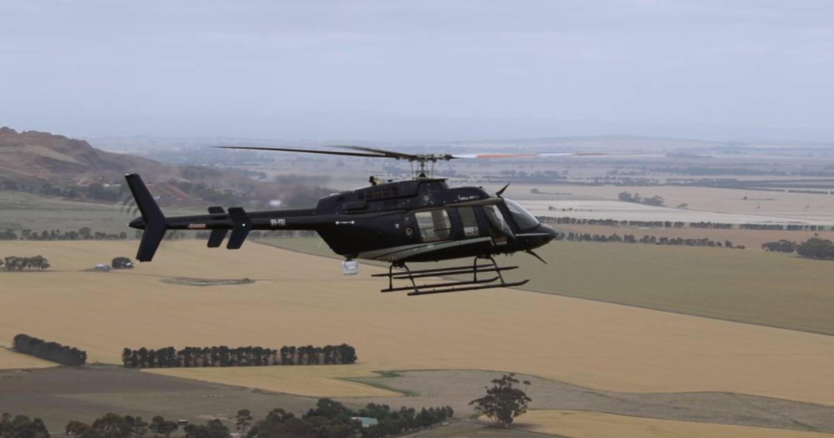
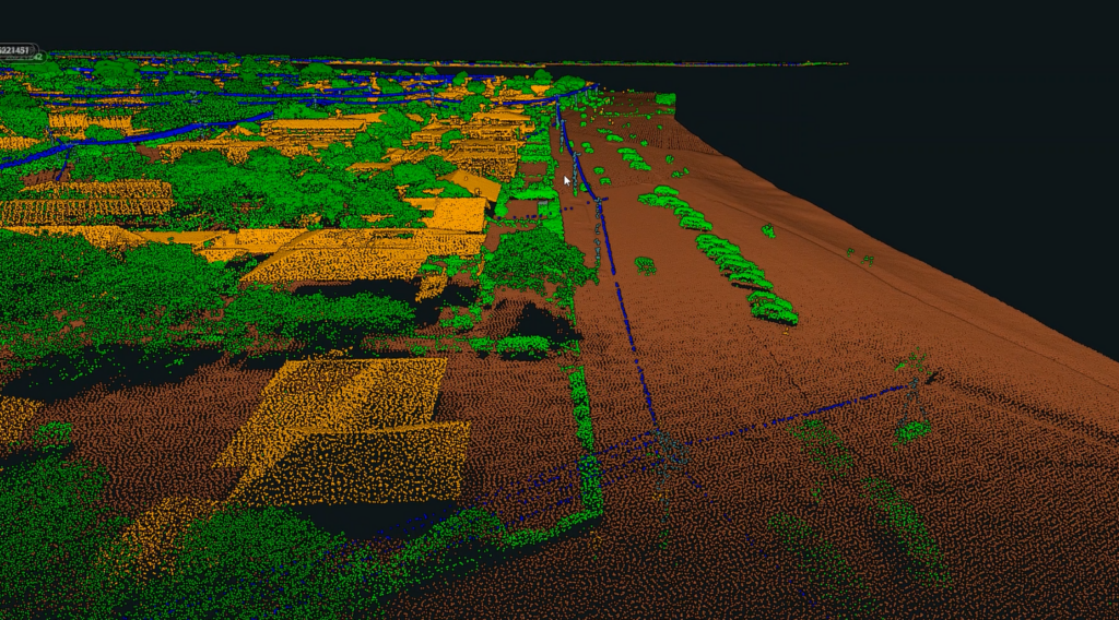
Flying at about 300m above ground, the helicopters use light detection and ranging (LiDAR) technology to measure the distance between vegetation and powerlines. Photo: Powercor.


Don’t be surprised if you hear the steady thrum of helicopters overhead in the coming weeks.
Aircraft will be scanning powerlines across the Surf Coast, Bellarine Peninsula and parts of Golden Plains, including Bannockburn, Teesdale and Meredith, as part of a major bushfire mitigation effort.
The aerial inspections, led by Powercor, will run for the next three weeks, with Geelong’s urban areas to be covered later this year.
Flying at about 300m above ground, the helicopters use light detection and ranging (LiDAR) technology to measure the distance between vegetation and powerlines.
The data is then used to build detailed 3D models, helping crews identify where trees need to be trimmed to maintain safe clearances.
Powercor’s head of vegetation management, Ayce Cordy, said the annual inspections play a key role in reducing fire risk and maintaining network reliability.
“Inspecting and managing vegetation growing near powerlines is an essential part of how we keep power safe and reliable for our customers,” Cordy said.
“By capturing data every year, we can track growth rates of vegetation across our network, helping us plan where to cut right now and when we may need to conduct cutting in the future.”
Each year, Powercor deploys a fleet of three helicopters to inspect more than 77,000km of powerlines across western Victoria.
Clearance requirements are set by Victoria’s energy safety regulator, Energy Safe Victoria, with larger buffer zones required in high bushfire risk areas.
Share


Related Articles

Free V/Line travel after 24-hour rail shutdown: here’s when
Two days of free V/Line travel have been announced for…
Press Council celebrates 50 years
The Australian Press Council is marking its 50th anniversary by…