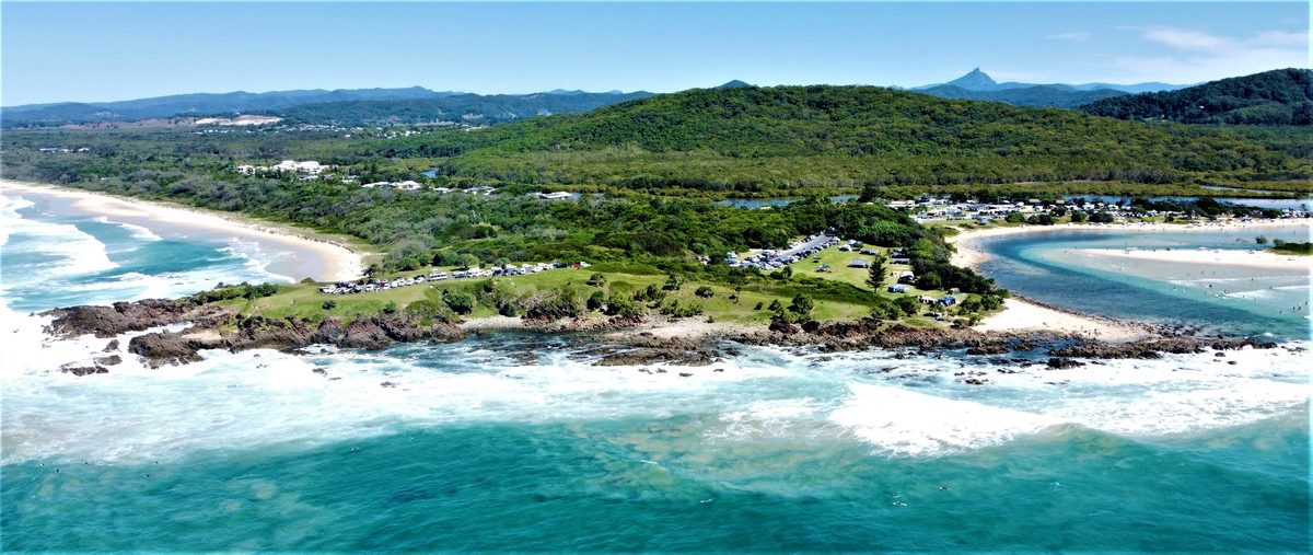
Hastings Point headland plan targets erosion and cultural protection as visitor numbers surge
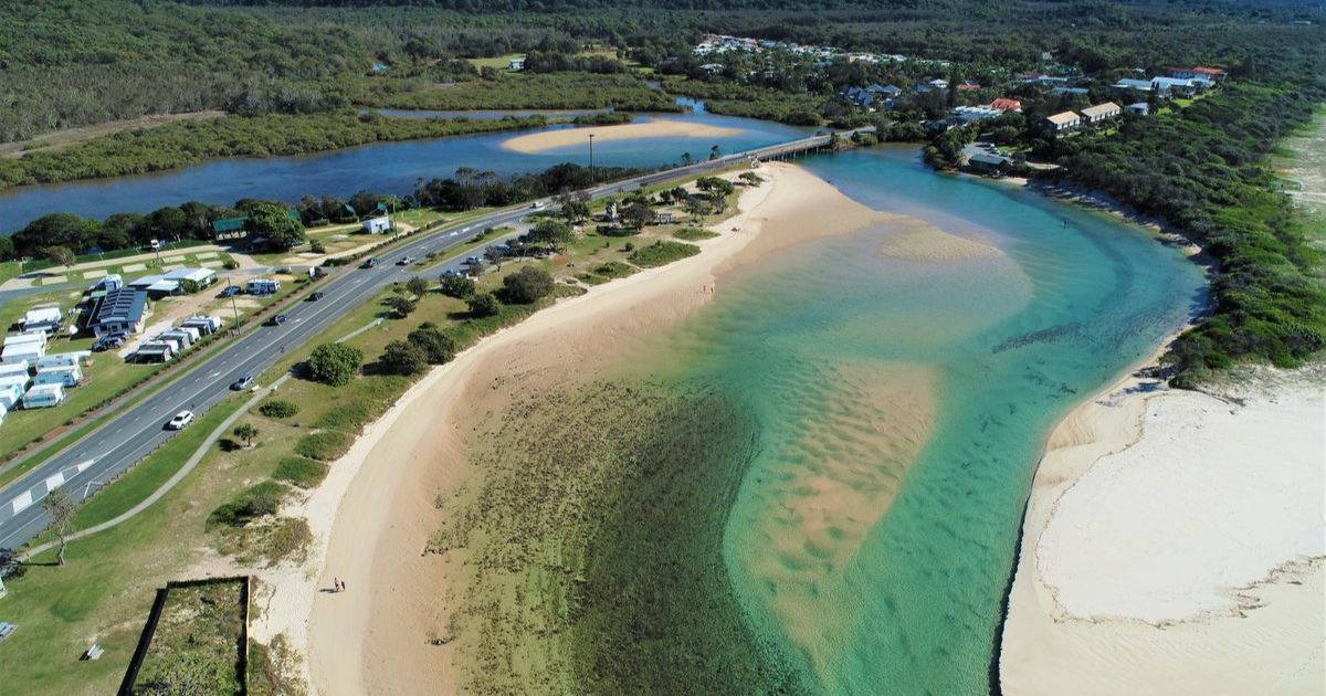
Hastings Point estuary. Photo: Supplied


A new management plan for Hastings Point headland will begin by stabilising key access tracks, as council responds to rising visitor numbers and growing erosion at the popular coastal site.
The project follows a three-year planning process and two rounds of community consultation, with council’s coast and waterways team leader Tom Alletson saying it is now moving into an approvals phase.
“It’s a vision for the area and how people can expect it to be managed into the future,” he said.
Alletson said the first stage of works would focus on improving safety and reducing erosion along heavily used tracks across the headland.
“The first thing that we’ll be doing is stabilising some of the access points on the headland,” he said.
He said the site was under increasing pressure from growing visitation.
“The issue at Hastings Point is that it’s being loved to death,” he said.
“That’s the expression that people often reach for because it’s such a lovely place and it’s so popular.”
Alletson said community feedback showed a desire to retain the character of the headland while managing higher levels of use.
“What the community told us is that we need to keep it just how it is, but cater for the many more thousands of people who are using it all the time,” he said.
The plan identifies three main access routes for early works: a track to South Beach, a rocky slot track to the rock platform, and a third route running from near the local shops through sandy terrain toward the creek and oyster reef.
Alletson said the focus would be on reducing erosion from foot traffic through low-impact upgrades.
“The first objective is to undertake works to stabilise those tracks in as low impact a way as we can,” he said.
Works will include sandstone steps and small-scale structures designed to follow natural landforms.
“These will be national park-style tracks, that work as much as possible with the natural lay of the land,” Alletson said.
A key constraint is the presence of Aboriginal cultural heritage material in parts of the headland, including midden sites near creek and beach access areas.
Alletson said these areas require minimal disturbance.
“One of the constraints that we’ve got in that area is that there’s midden material in the creek bank,” he said.
“You have to really avoid ground disturbance.”
In these locations, council is proposing raised, lightly built structures to allow access while protecting sensitive cultural material.
While the plan has been adopted, Alletson said construction timelines depend on approvals and funding.
He said council must complete archaeological assessments and secure permits before works can begin.
“We’ve got concept designs and we’re now going into an approval phase of the project,” he said.
Future stages will depend on budget and external funding, with works likely to be delivered progressively.
Alletson said the need for action has become more urgent as visitor numbers continue to rise along the Northern Rivers coastline.
“I’ve got a sense that now is the time we really need to get stuck into it,” he said.
Share


Related Articles
Local health, education projects to receive multi-million-dollar injection through state budget
New ambulance stations, expanded maternity services and ongoing flood recovery…
ED and surgical activity remains high as acuity levels rise across Northern NSW hospitals
EMERGENCY departments and surgical theatres across Northern NSW Local Health…