Ballina braces for heavy rain, strong winds and king tides
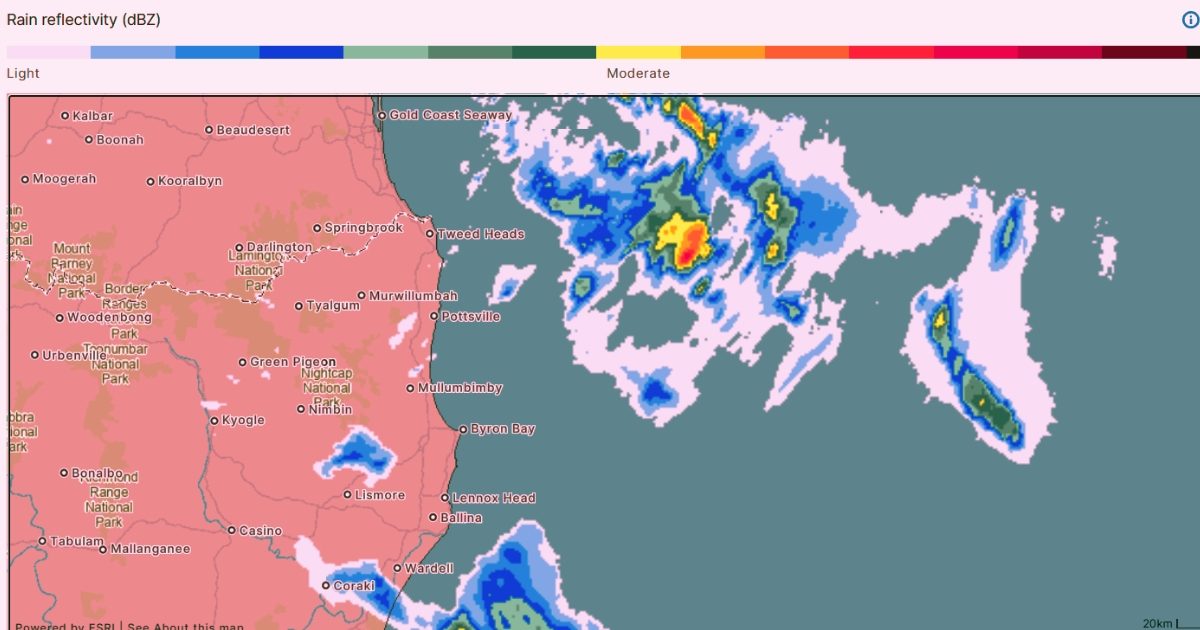
Bureau of Meteorology weather radar shows rainfall across the Northern Rivers at 11:20 am on Thursday. Photo: Bureau of Meteorology.


Ballina is bracing for heavy rain, strong winds and king tides, with up to 185mm of rain forecast by Sunday and motorists warned to watch for saltwater flooding on low-lying roads.
A Strong Wind Warning is in place for the Byron Coast waters on Thursday and Friday, with hazardous marine conditions expected.
Bureau of Meteorology forecaster Jonathan How said the heaviest falls were expected along the coastal fringe, particularly from Byron Bay to the Queensland border.
“We are seeing some very persistent onshore south-easterly winds pushing onto the coast,” How said.
“This is the wind direction that pushes the cloud and showers.”
Significant rainfall is forecast across the region, with Byron expected to receive between 10mm and 110mm on Thursday, followed by 10mm to 50mm on Friday, 8mm to 40mm on Saturday and 5mm to 15mm on Sunday.
If the upper end of the forecast is reached each day, Byron could receive up to 215mm between Thursday and Sunday.
Ballina could receive up to 185mm over the same period, while East Lismore could receive up to 130mm and Tweed Heads up to 125mm if the highest rainfall forecasts eventuate.
Ballina Shire Council has also warned king tides on Thursday evening could cause saltwater flooding on several low-lying roads. Motorists, motorcyclists, pedestrians and cyclists are being urged to avoid affected roads where possible.
Roads likely to be affected include Tamar Street, Riverside Drive, River Street, Burns Point Ferry Road, North Creek Road, Southern Cross Drive, Uralba Road, Old Bangalow Road and Tamarind Drive.
How said some areas could receive triple-digit rainfall totals over the next two days, but widespread flooding was not expected.
“We’re not expecting big rainfall totals leading to flooding, but certainly reminding people to keep an eye on the radar and keep your umbrella or jacket handy and take care on the road as well,” he said.
A high tide of 1.91 metres is forecast at Ballina at 10.06pm on Thursday.
How said the combination of high tides, strong winds and waves could increase coastal impacts.
“With a sort of combination of high tides plus a lot of water being pushed onto the coast, it can mean that we do see those waves and tides become a bit more exacerbated,” he said.
“So it does mean that some of those low-lying areas on the beaches or on the coast could become inundated with water.”
How encouraged residents to monitor the latest forecasts and warnings, with anyone heading to the coast urged to take extra care due to strong winds, choppy conditions and the potential for beach erosion.
Bureau of Meteorology weather radar shows rainfall across the Northern Rivers at 11:20 am on Thursday. Photo: Bureau of Meteorology.
Share


Related Articles

Top golfers to tee off ona the Northern Rivers in hopes of qualifying for NSW Open
THE Northern Rivers will host some of the best golfers…
Students pitch ideas to council around flood technology and community support for youth week
BALLINA Shire Council hosted local high school students for a…