Flash flood aftermath prompts warning system scrutiny
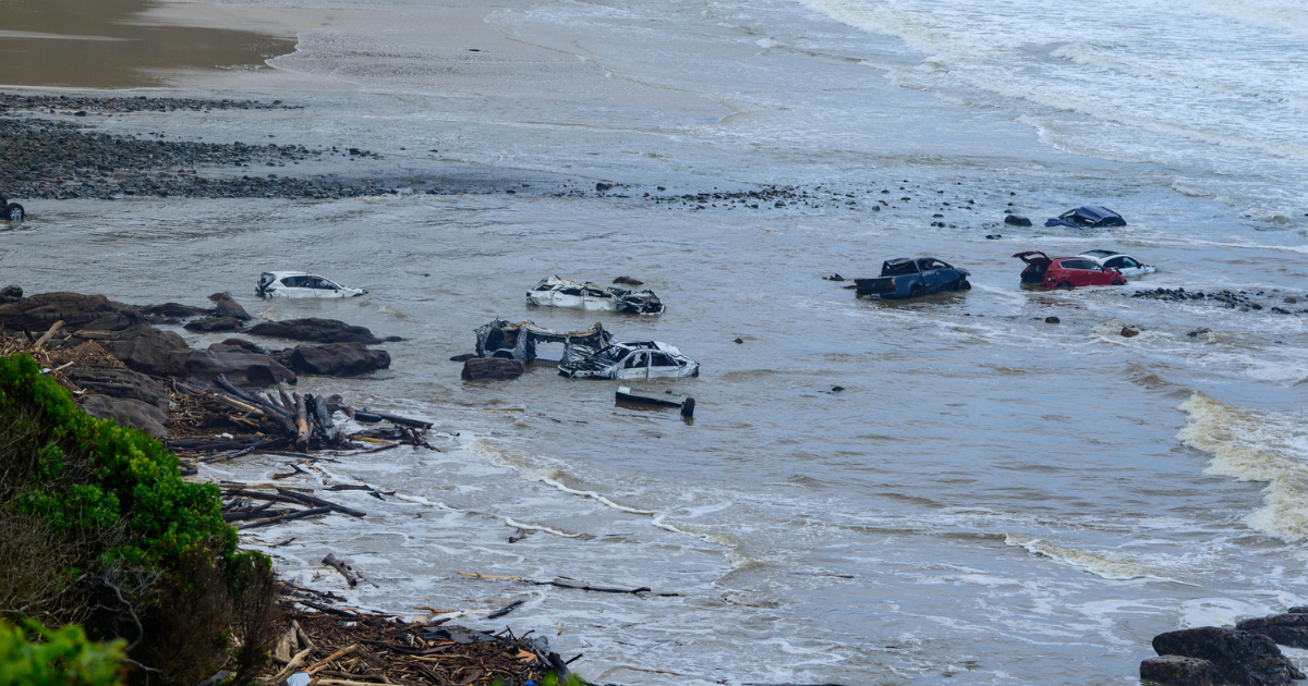
Cars were washed out to sea as flash flooding tore through Lorne and Wye River on Thursday. The timing of the emergency warnings are now under scrutiny. Photo: MICHAEL CURRIE/AAP


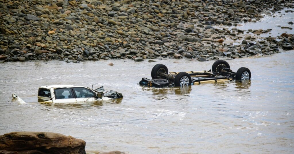
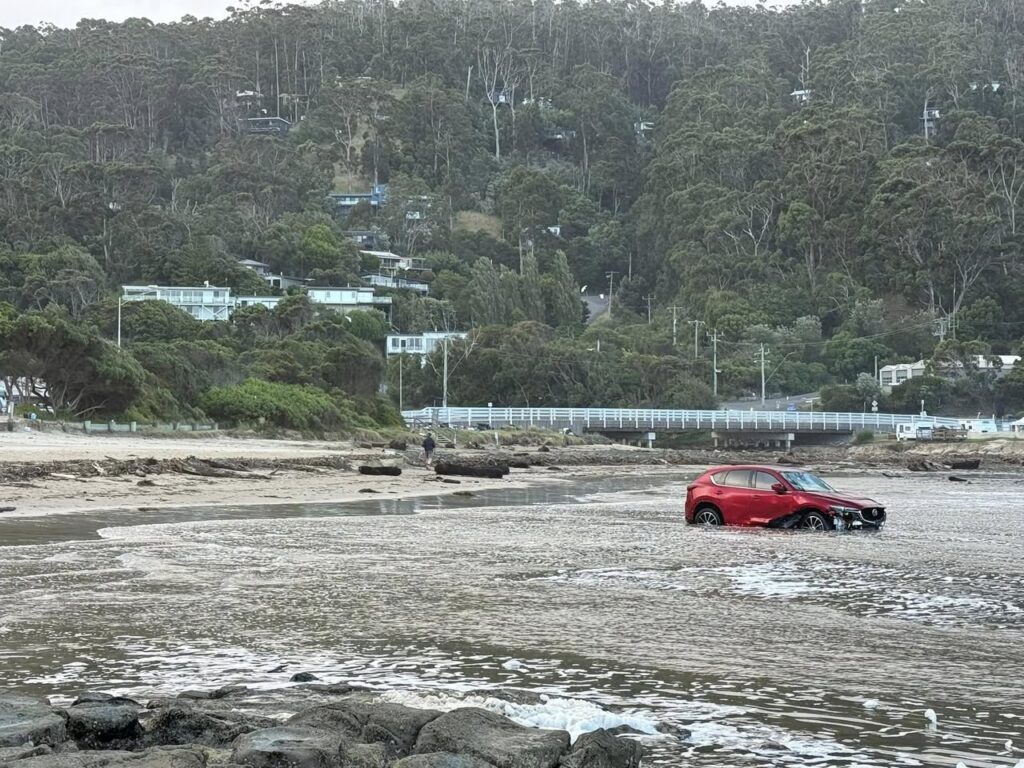
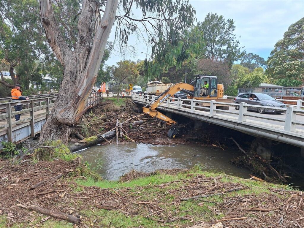
Communities along the Surf Coast have begun the long task of recovery after destructive flash flooding tore through river catchments and caravan parks on Thursday, washing vehicles into the sea and leaving significant damage across Lorne and Wye River.
Rivers broke their banks as intense, highly localised rainfall triggered life-threatening flooding, sweeping through low-lying areas, creek crossings and coastal campgrounds.
Caravans were seen floating offshore and multiple vehicles were carried downstream as floodwaters surged toward the ocean.
Authorities estimate between 10 and 20 cars may have been lost, though assessments are ongoing and several vehicles remain unaccounted for.
As clean-up efforts continue, questions have been raised about the timing and adequacy of warnings issued ahead of the rapidly escalating flood event.
Fronting the media on Friday, emergency management commissioner Tim Wiebusch said the warnings had been “as timely as can be”.
“We do believe that the warnings were adequate for what was needed at that point in time and were as timely as can be,” he said.
The Bureau of Meteorology issued a severe thunderstorm warning at 11.57am on Thursday, which was upgraded to include life-threatening flash flooding at 12.40pm. A Watch and Act warning followed at 12.58pm.
Emergency alerts were also sent to more than 10,000 mobile phones, Wiebusch said.
The first triple-zero call linked to flooding at a Wye River holiday park was received at 1.08pm, followed by another at 1.20pm.
“We understand the water came up very quickly and that is the case of flash flooding,” Wiebusch said.
“When we see severe thunderstorms, they can appear and be in the landscape within 20 to 30 minutes without a lot of time to provide warnings.
“But in this case, thunderstorm warnings had been out for just over an hour before we started to see some of those impacts.”

Risk period just beginning
The Bureau of Meteorology’s Diane Eadie on Friday said there was the potential for severe thunderstorms to develop across western parts of Victoria on Monday.
Authorities are also anticipating a renewed period of heightened fire danger over the Australia Day long weekend, with Friday and Saturday expected to be the peak of the next fire period.
Speaking from the State Control Centre on Friday, emergency management commissioner Tim Wiebusch warned the risk period has only just begun.
“We’re still very early in our summer season, and the risk of fires, flash flooding [and] storms will be with us for many more weeks yet as we go through the coming months,” he said.
“We need the community to remain alert to conditions. Make sure you have downloaded the VicEmergency app.
“Know where to get the latest emergency information – either through the app, the website, or our emergency broadcasters – but heed the warnings that are in place.”
Share


Related Articles

Winter festival returns with new rides
A 45m ice toboggan and a towering new drop ride…
From campus groups to sporting clubs, queer spaces help build community
LOCAL advocates say dedicated queer spaces remain vital in Geelong…