Fairhaven waits on fix for unstable slope
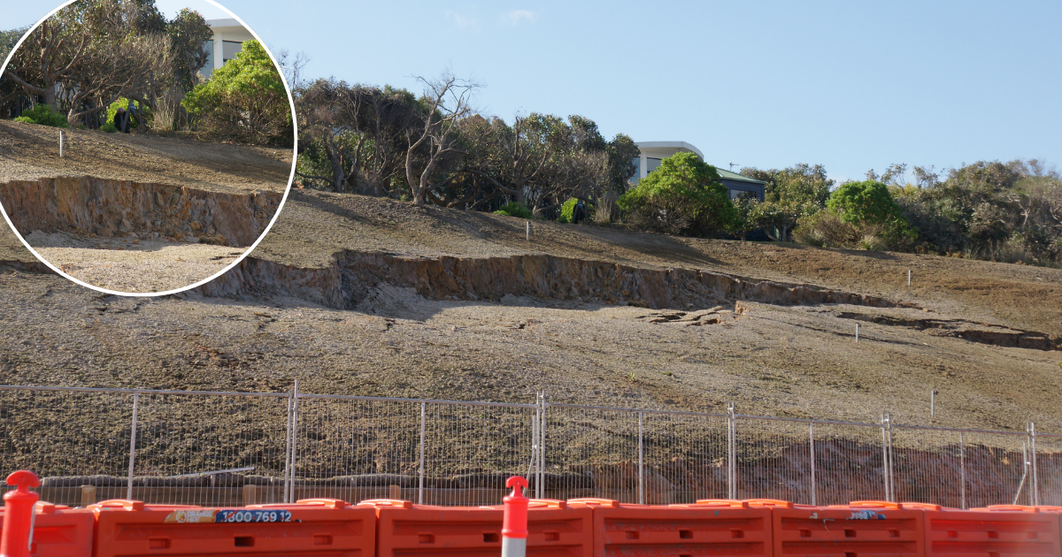
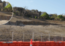
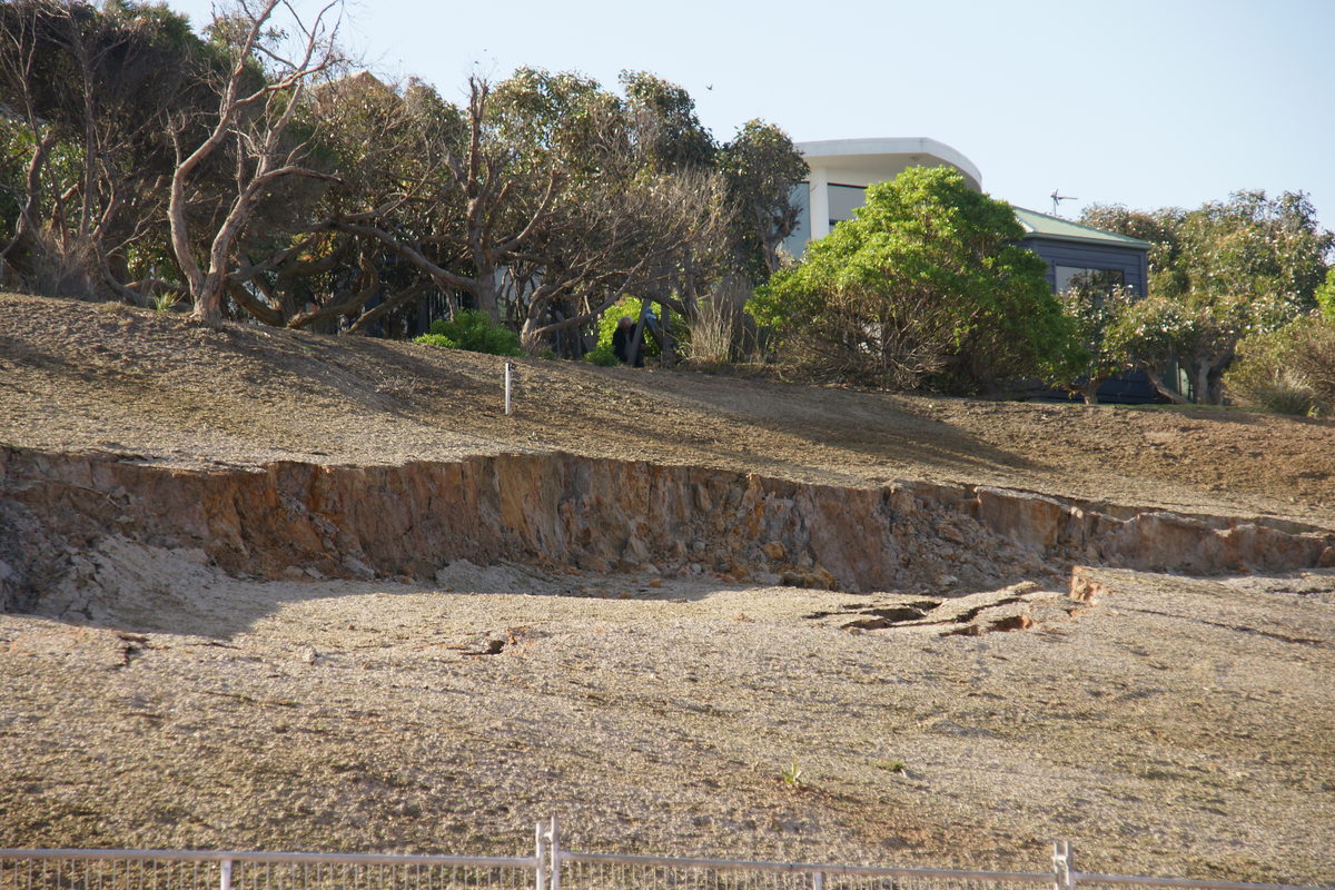
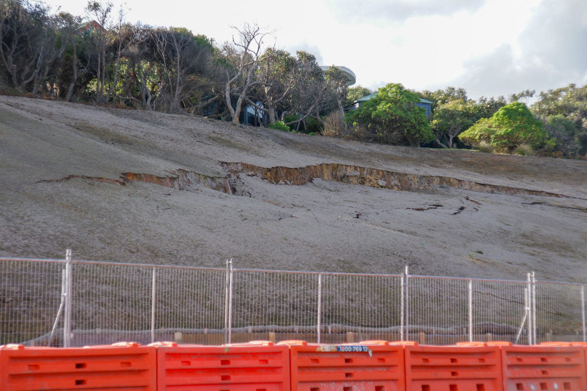
Since the landslip occurred in early July, the 100-metre slope has experienced further ground movement, with the existing cracks slowly extending across the slope. This photo was taken on September 8. Photo: ELLIE CLARINGBOLD


A LONG-TERM solution for a landslip-affected embankment in Fairhaven may be edging closer, with a full geotechnical report for the site expected in November.
Since the most recent landslip occurred in early July, the 100-metre slope — near the corner of the Great Ocean Road and Lialeeta Road, west of the Painkalac Creek Bridge — has experienced further ground movement, with the existing cracks slowly extending across the slope.
In August, geotechnical monitoring stations were installed at key points along the embankment and retaining wall to measure any movement above and below the landslip.
Chris Pike, the shire’s general manager of placemaking and environment, said these measurements would help build an understanding of the extent of the landslip, including the size of the slip plane and groundwater issues.
“Initial findings have shown that surface water flows, inadequate drainage at the top of the embankment and a potentially high groundwater table are contributing to the landslip,” he said.
“Monitoring has recorded minor movements over the past three weeks, mostly during rainfall.
“We’re expecting to receive the full report from the geotechnical consultant in early November, which will include recommendations for long-term solutions.”
Ongoing concerns of potential instability through the area, particularly during periods of rainfall, have seen the temporary fencing and safety barriers installed at the site continually revised, with the exclusion zone encroaching increasingly onto the road.
“We’re focused on ensuring everyone’s safety and so temporary measures, including traffic management, must remain in place until we’re clearer about the current risk and the way forward,” Mr Pike said.
“We’ll continue to review these regularly.
“We thank the local community for their patience and understanding as we work through this complex issue.”
Once filled with vegetation, the embankment was cleared in 2020 by Forest Fire Management Victoria to create a strategic fuel break, as part of a joint bushfire risk management program conducted in partnership with the shire and the CFA.
It is a move many locals believe has led to ongoing collapses and landslips at the site.
In July, the shire’s then-acting general manager of placemaking and environment, Gabby Spiller, said efforts to revegetate the embankment after the initial landslip did not germinate due to dry conditions.
“Council is assessing drainage improvement options and plans to revegetate the embankment with native species to help stabilise the slope and reduce the moisture content in the soil,” she said at the time.
Share


Related Articles

Baby boom brings first parents’ group in years
A SURGE in births across Anglesea and Aireys Inlet has…
Meli launches annual appeal for children in care
MELI’S Foster a Future Appeal has launched for another year,…